
I say "attempted" because on 3 separate occasions I couldn't get more than halfway up the summit due to either the mud or the snow & ice. Finally, this past weekend, I tried out the chains for my car and successfully made it to the very top of the mountain.
In my search for information on this mine, I eventually found a web site that mentionned a mine on Blue Grouse Mountain. Here is the text I found:
Our journey begins with an ascent of Blue Grouse Mountain. From it's 1250 metre (4100 feet) summit, we have an unparalleled view of Kelowna and the Okanagan Valley. We travel through a back trail to find abandoned Blue Hawk gold mine. Abandoned in 1938 after 4.5 tons of high grade gold ore was mined in 1934. The vein quickly played out but various exploration projects have been conducted over the years with the final work in 1993. The drill core found at the site is from that last effort and the quartz vein on surface illustrates the gold forming process [...]
Prior to this web reference, I didn't know the name of the mine. Once this was found, a quick trip to British Columbia's Ministry Of Energy And Mining provided me with this additional information:
Minor gold and silver production from veins is also recorded from the Blue Hawk (082ENW002), [...] mines.
The identifier "082ENW002" was labeled on a British Columbia Energy And Mining map as the following coordinates:
49° 59' 02" N
119° 31' 06" W
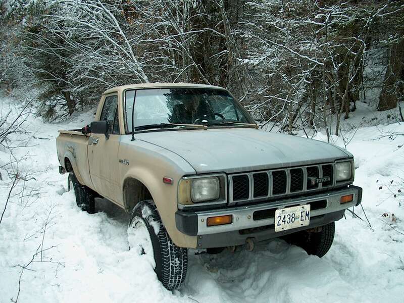
With Dietmar's Magellan SporTrakPro GPS, Josh and I went hunting for the mine. His truck has much more clearance than my car, but even so we eventually got stuck in the snow on these unplowed roads. We used snowshoes to travel the remaining 2 KM. Near the GPS coordinates from the BC mining map, we found many core samples, but no evidence of a mine shaft.
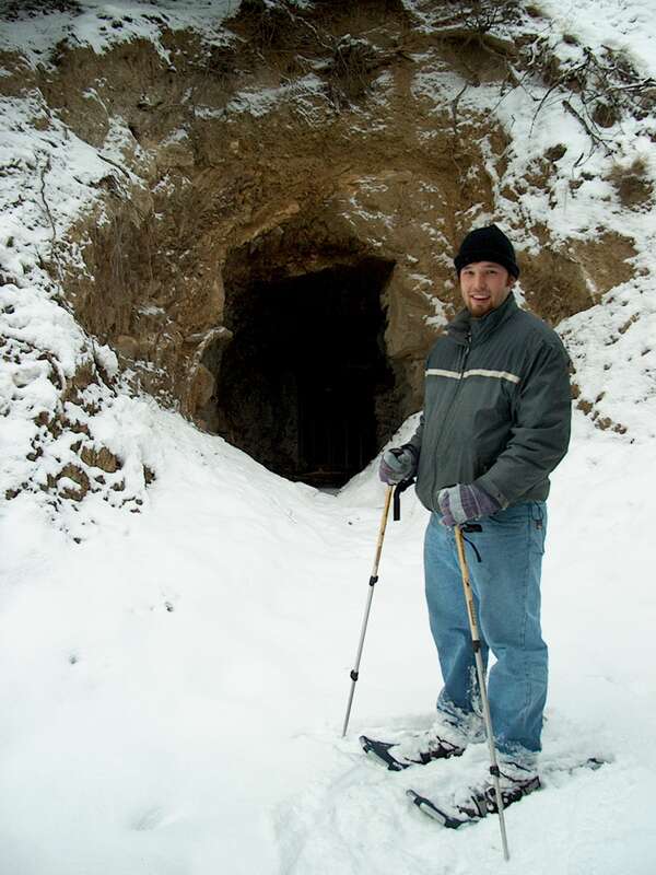
Our search of the area lasted perhaps 45 minutes. We were getting ready to head back to the truck when a last look down a secondary trail finally led us to the entrance of the mine! The actual coordinates are:
49° 59' 02" N
119° 30' 59" W
965 meters
The entrance is partially flooded, much like many of the old mines I explored 2 summers ago in Rock Creek Provincial Park. Perhaps in the summer, when the water wont be so cold, we'll get a chance to have a look inside. For now, I'm simply glad we finally found it.
I also took a waypoint at the location where the trail to the mine branches off from the main Blue Grouse Mountain summit road:
49° 57' 34" N
119° 31' 11" W
1002 meters
Now this is a GeoCache worth searching for!
UPDATE: I've gone back to the mine (2004-June-13) and the pictures are quite nice!
 2003-12-13 23:55:01 |
 2003-12-14 00:08:58 |
 2003-12-14 01:15:16 |
 2003-12-14 18:54:49 |
 2003-12-14 18:55:04 |
 2003-12-14 19:12:03 |
 2003-12-14 21:35:58 |
 2003-12-14 21:36:33 |
 2003-12-14 21:49:03 |
 2003-12-14 21:49:51 |
 2003-12-14 21:50:41 |
 2003-12-14 22:52:00 |