
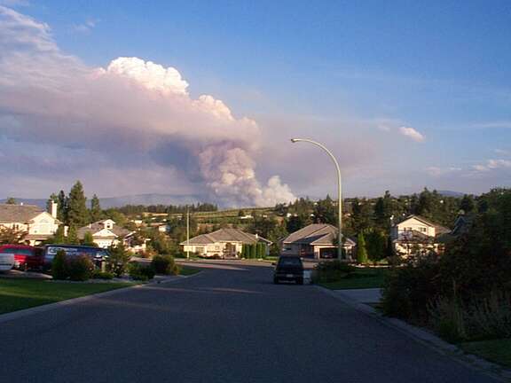
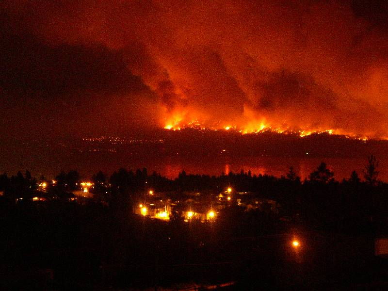
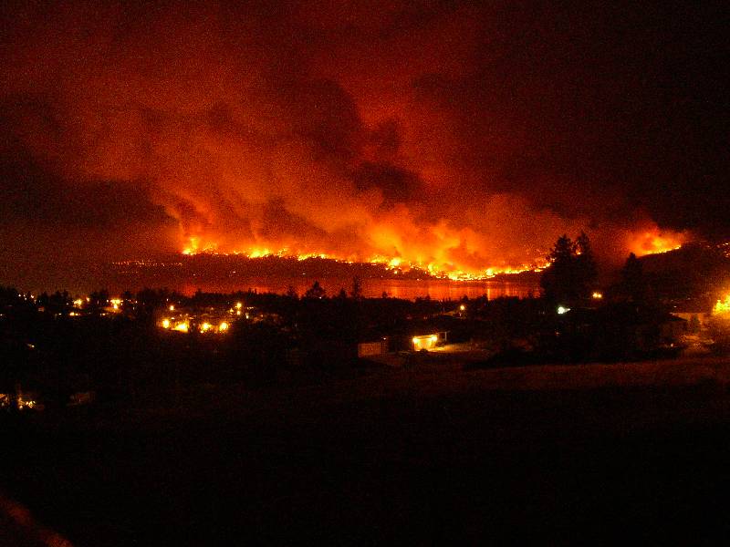
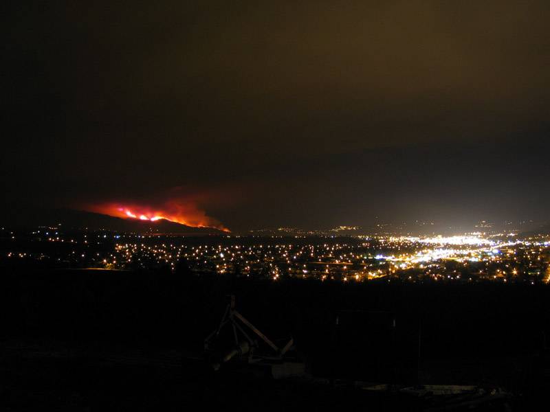
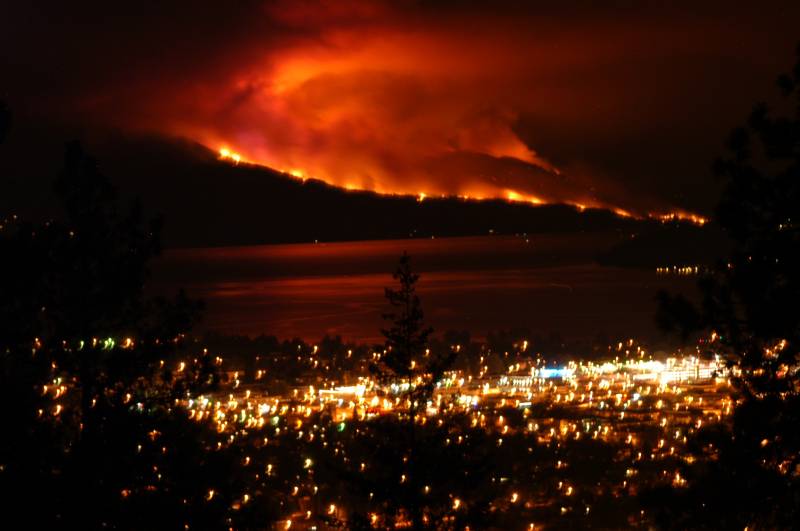
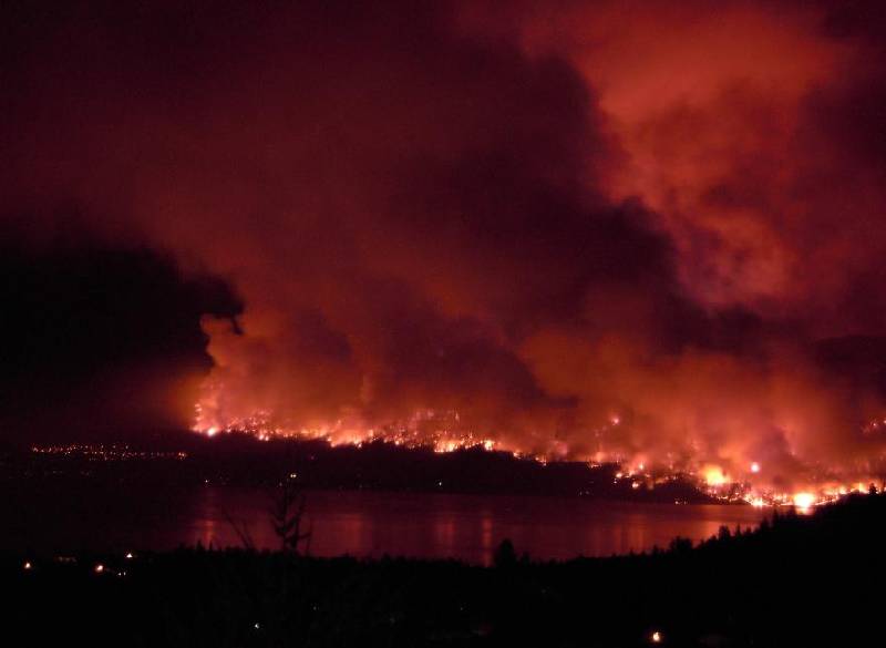
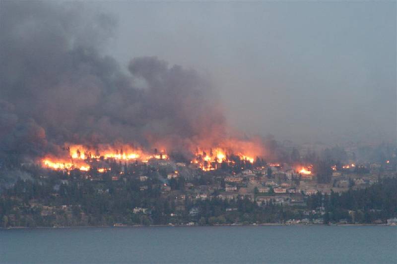
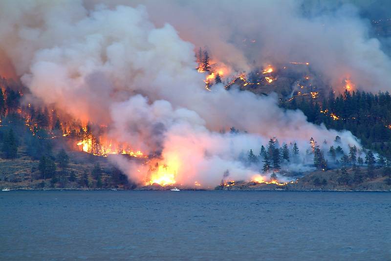
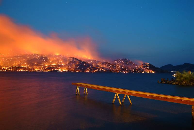
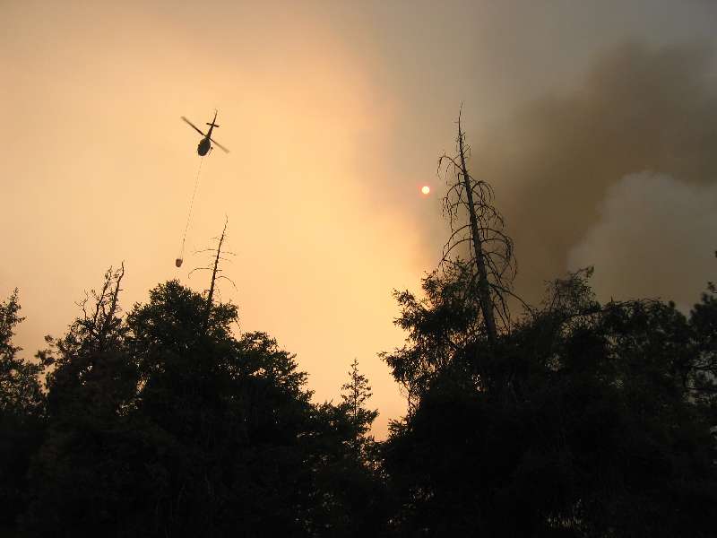
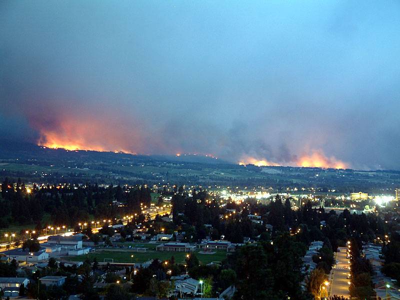
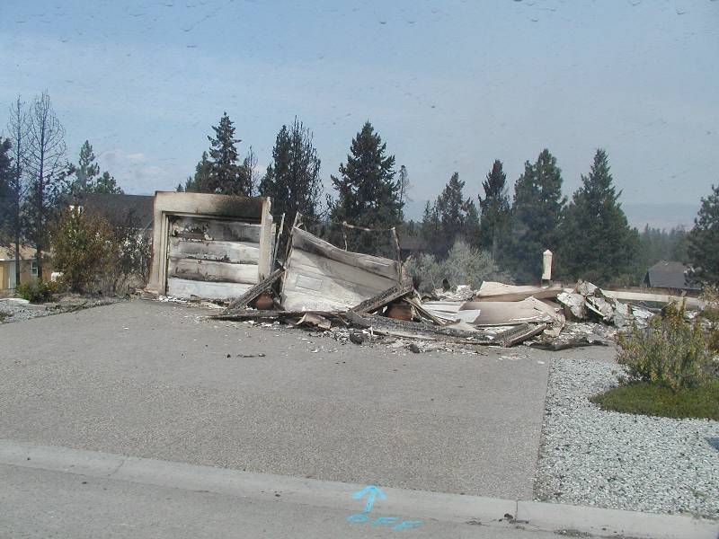
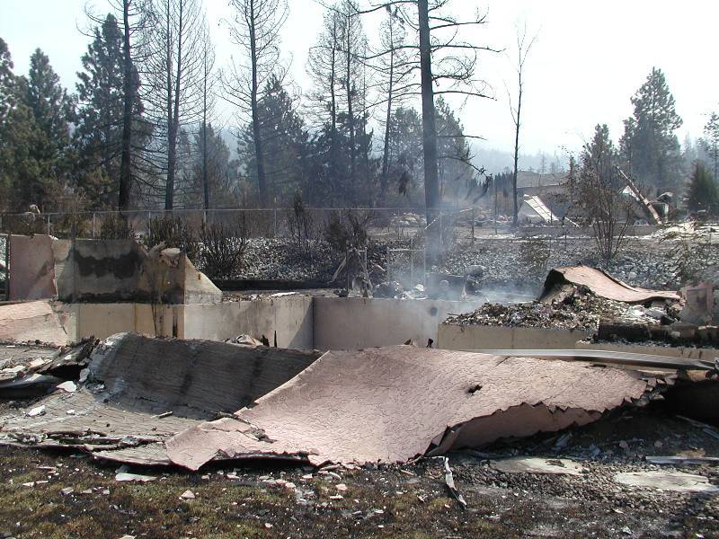
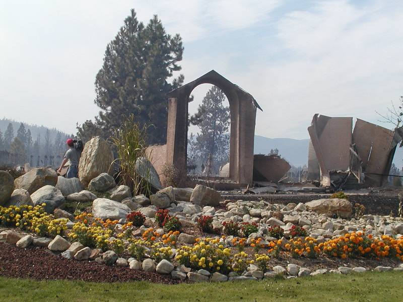
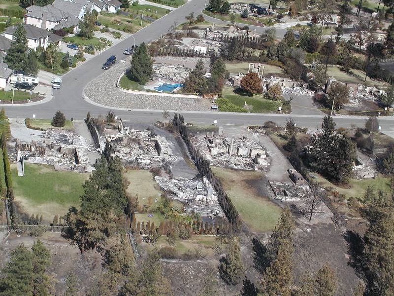
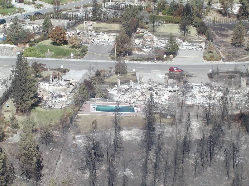
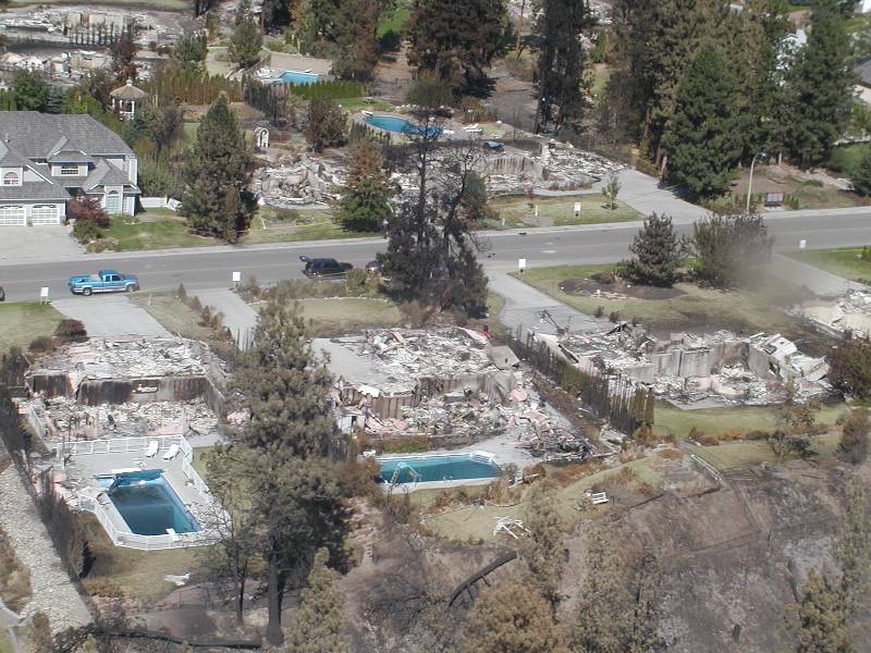
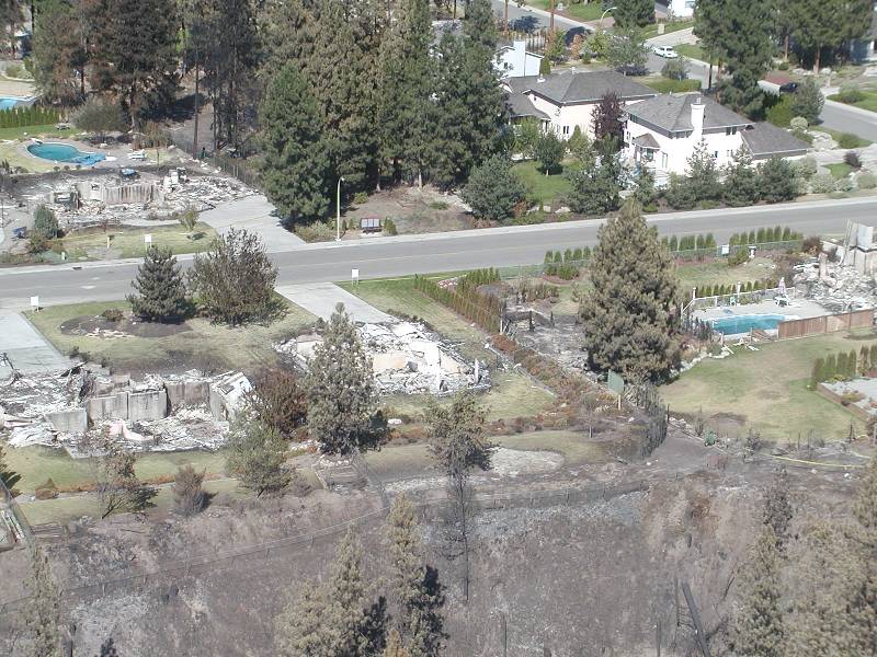
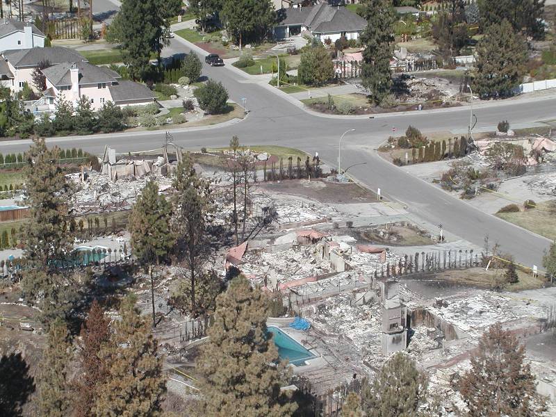
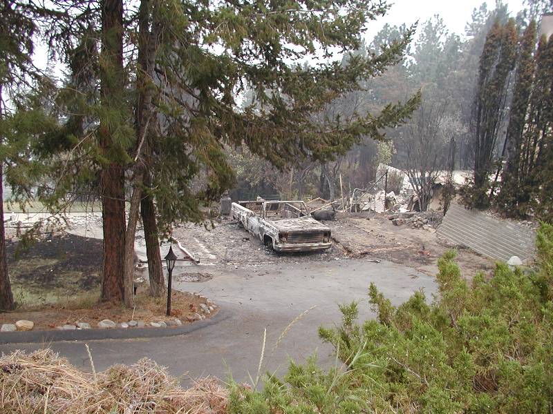
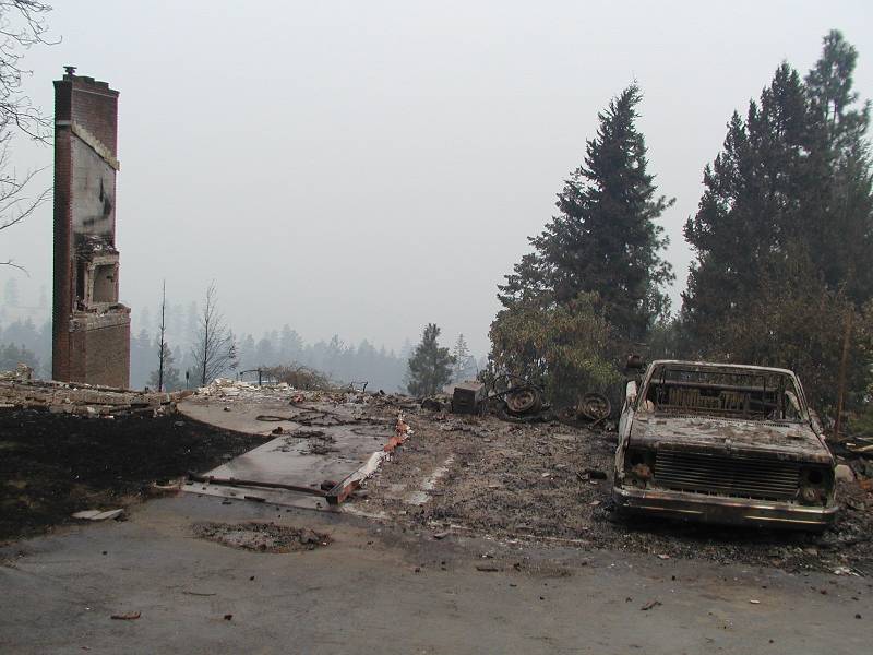
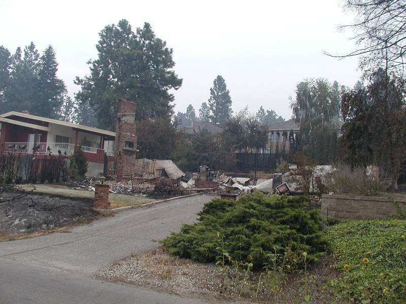
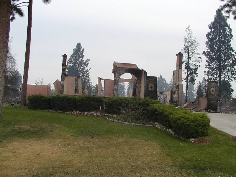
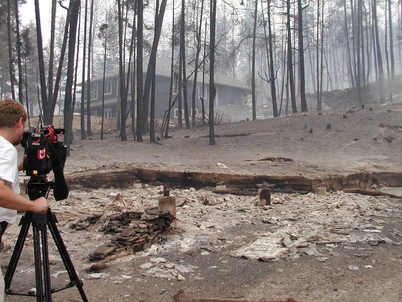
Most of these pictures were not taken by me, but were make available on a general Kelowna public news website.
| Date | Description | Map |
|---|---|---|
| Saturday August 16 |
|
N/A |
| Sunday August 17 |
|
N/A |
| Monday August 18 |
|
N/A |
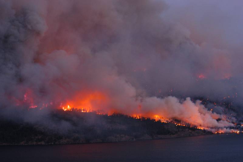
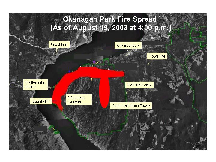
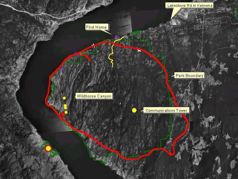
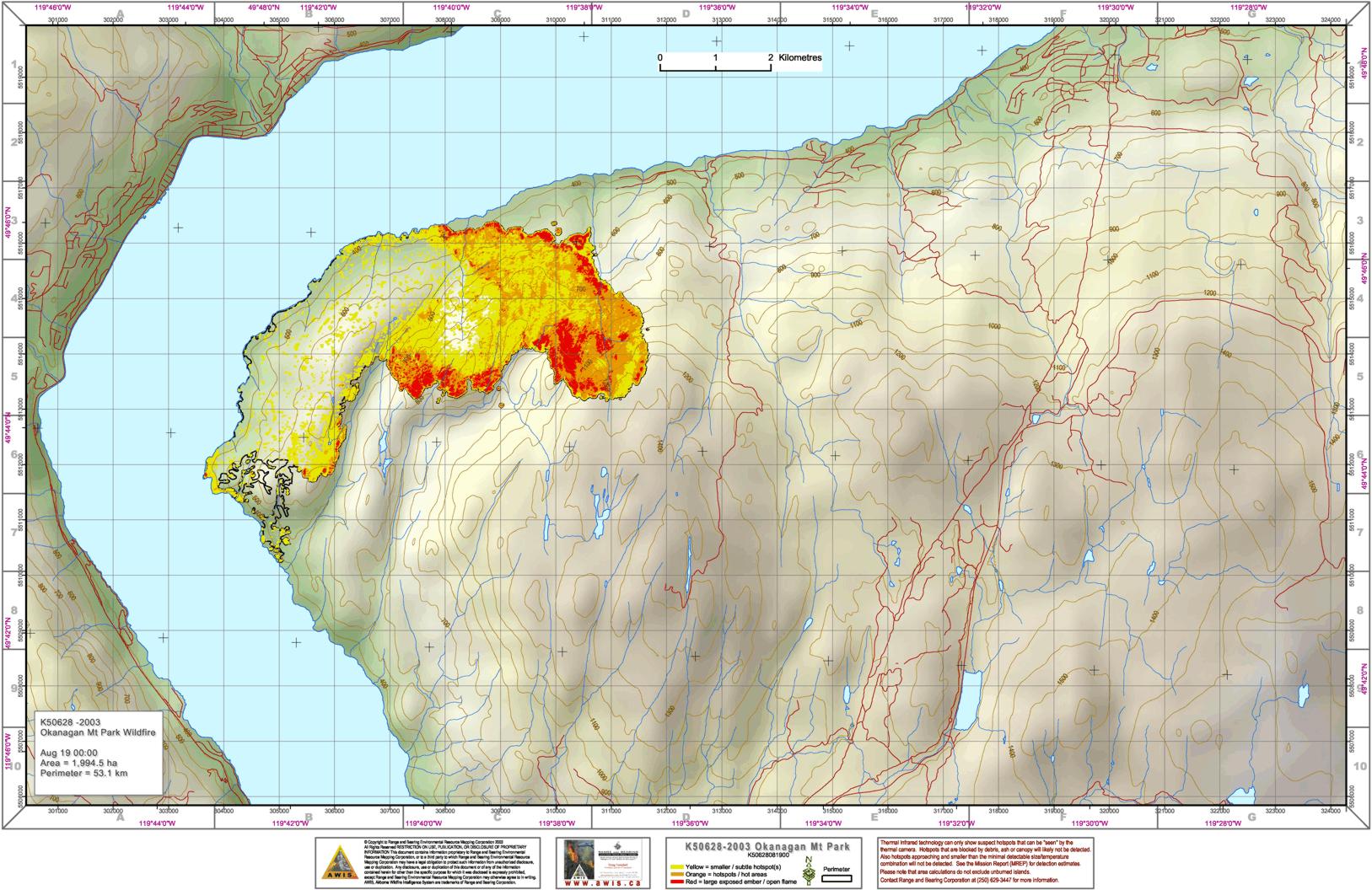
| Tuesday August 19 |
|
|
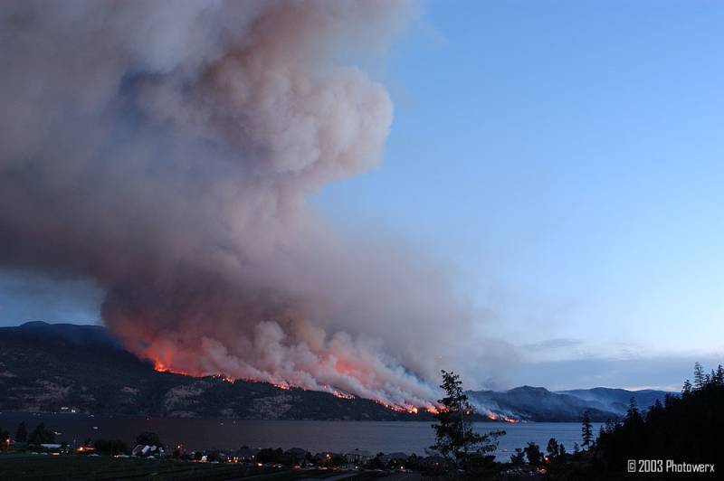
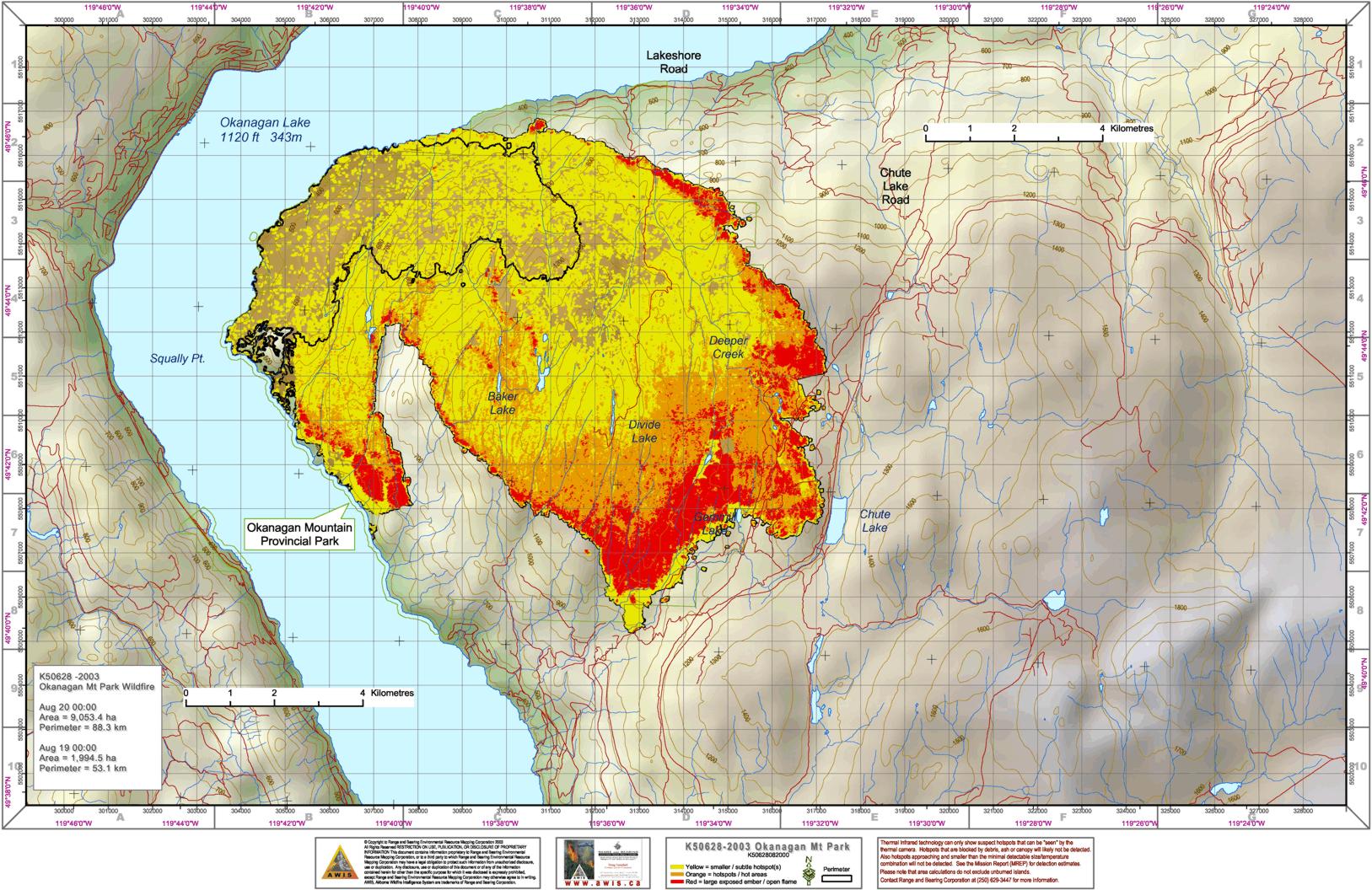
| Wednesday August 20 |
|
|
| Thursday August 21 |
|
|
| Friday August 22 |
|
|
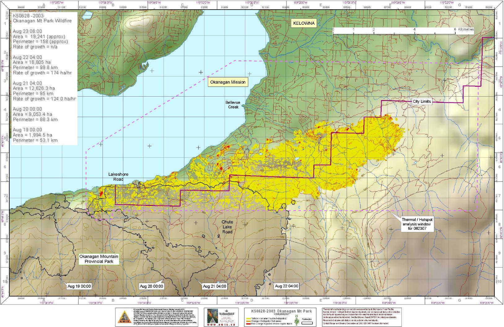
| Saturday August 23 |
|
|
| Sunday August 24 |
|
|
| Monday August 25 |
|
N/A |
| Tuesday August 26 |
|
|
| Wednesday August 27 |
|
|
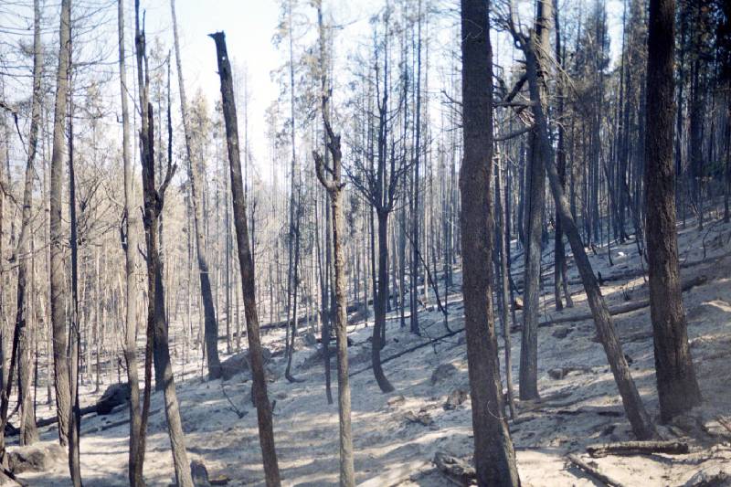
| Thursday August 28 |
|
|
| Sunday August 31 | N/A | |
| Wednesday September 3 | N/A | |
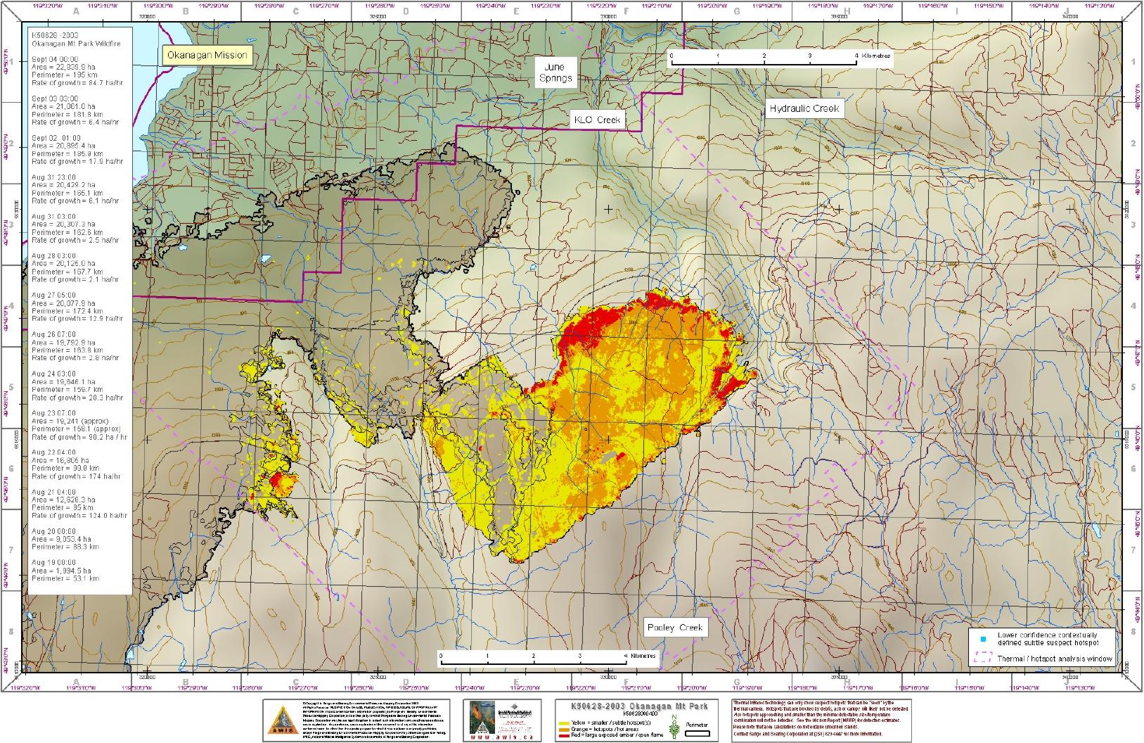
| Thursday September 4 |
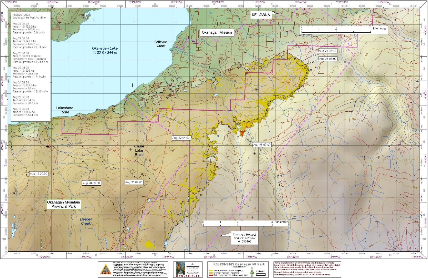
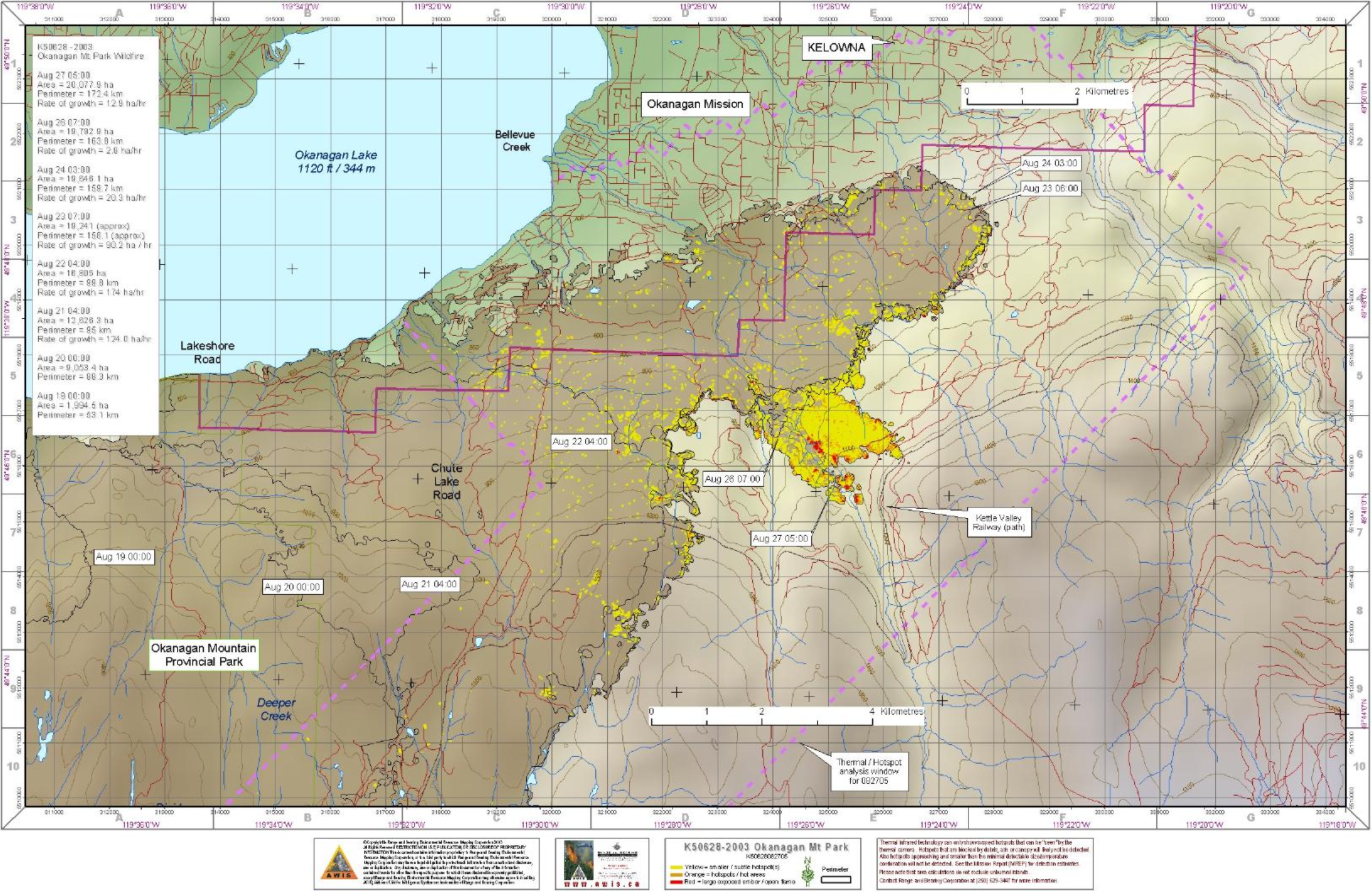
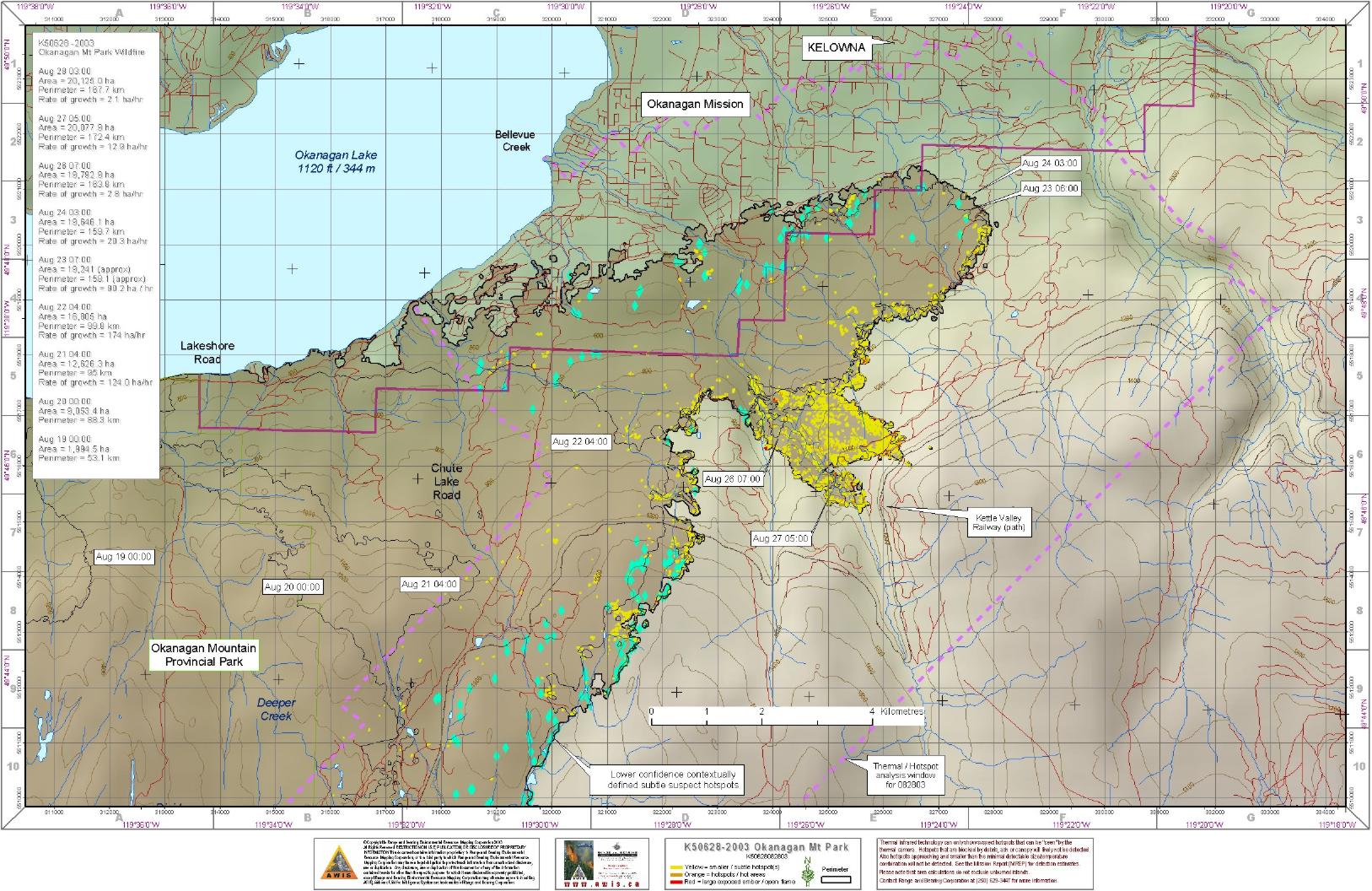
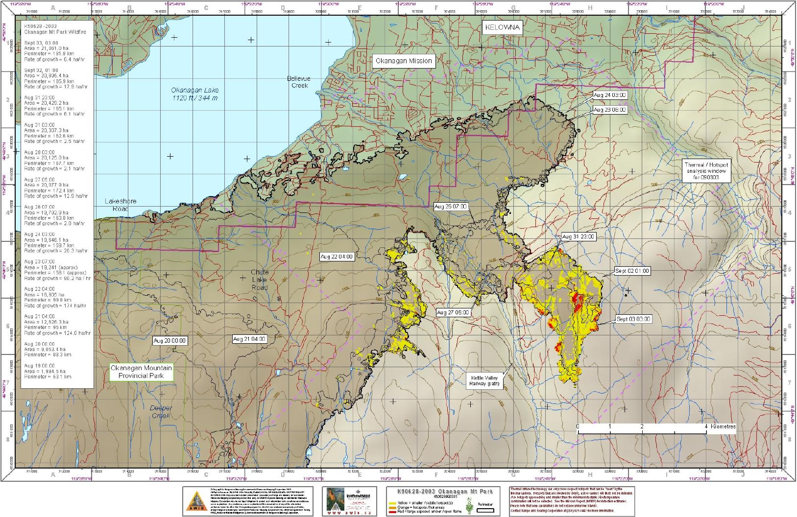
For those not familiar with the metric system, 1 hectare = just under 2.5 acres.
Last update: Friday September 5, 06:00 PDT.
 2003-08-27 01:39:05 |
 2014-09-28 22:50:37 |
 2014-09-28 22:50:36 |
 2014-09-28 22:50:36 |
 2014-09-28 22:50:36 |
 2014-09-28 22:50:37 |
 2014-09-28 22:50:37 |
 2014-09-28 22:50:37 |
 2014-09-28 22:50:36 |
 2014-09-28 22:50:36 |
 2014-09-28 22:50:37 |
 2014-09-28 22:50:36 |
 2014-09-28 22:50:36 |
 2014-09-28 22:50:36 |
 2014-09-28 22:50:36 |
 2014-09-28 22:50:37 |
 2014-09-28 22:50:36 |
 2014-09-28 22:50:37 |
 2014-09-28 22:50:36 |
 2014-09-28 22:50:37 |
 2014-09-28 22:50:36 |
 2014-09-28 22:50:36 |
 2014-09-28 22:50:37 |
 2014-09-28 22:50:37 |
 2014-09-28 22:50:37 |
 2014-09-28 22:50:36 |
 2014-09-28 22:50:36 |
 2014-09-28 22:50:36 |
 2014-09-28 22:50:37 |
 2014-09-28 22:50:37 |
 2014-09-28 22:50:37 |
 2014-09-28 22:50:36 |
 2014-09-28 22:50:36 |
 2014-09-28 22:50:36 |
 2014-09-28 22:50:37 |
 2014-09-28 22:50:36 |
 2014-09-28 22:50:36 |
 2014-09-28 22:50:37 |
 2014-09-28 22:50:37 |
 2014-09-28 22:50:37 |
 2014-09-28 22:50:36 |
 2014-09-28 22:50:36 |
 2014-09-28 22:50:37 |
 2014-09-28 22:50:36 |
 2014-09-28 22:50:37 |
 2014-09-28 22:50:37 |
 2014-09-28 22:50:36 |
 2014-09-28 22:50:37 |
 2014-09-28 22:50:37 |
 2014-09-28 22:50:36 |
 2014-09-28 22:50:36 |
 2014-09-28 22:50:37 |
 2014-09-28 22:50:37 |
 2014-09-28 22:50:36 |
 2014-09-28 22:50:37 |
 2014-09-28 22:50:36 |


